
1. Network of grooves
We ask which segments connect, where they end, whether they form cycles and whether they share a branching point. A curve can change size or shape without losing these relationships.138
How stones ‘speak’ · 04
Exploring how engravings are organised on stone and how they might be compared with pottery and other regional contexts.

From figures to relationships
A petroglyph can be organised around centres, enclose other forms or divide a surface into fields. Examining these relationships takes us beyond a list of motifs towards an interpretation of the composition and the rock that bears it.
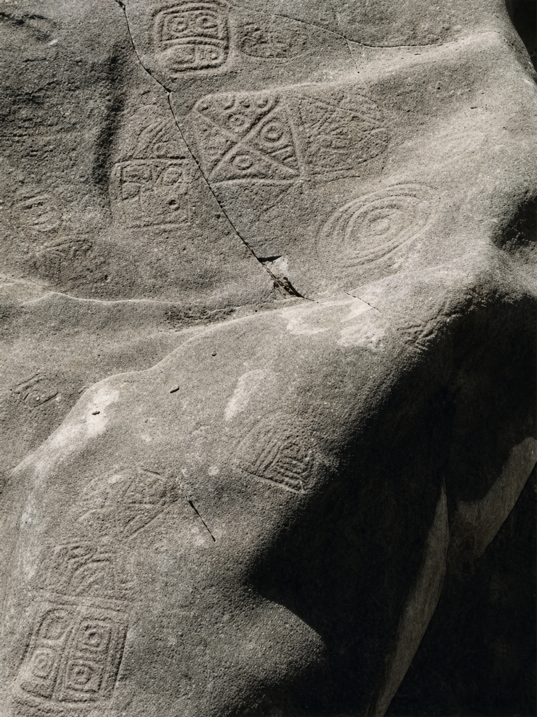
The twelve documentary records preserved in the project were reviewed: four from Itagüí, four from Barbosa and four from Girardota. They comprise eleven photographs and one tracing with a wide view and a detail. Their visible relationships suggest three especially useful operations for comparison: enclosing, subdividing and organising through axes.
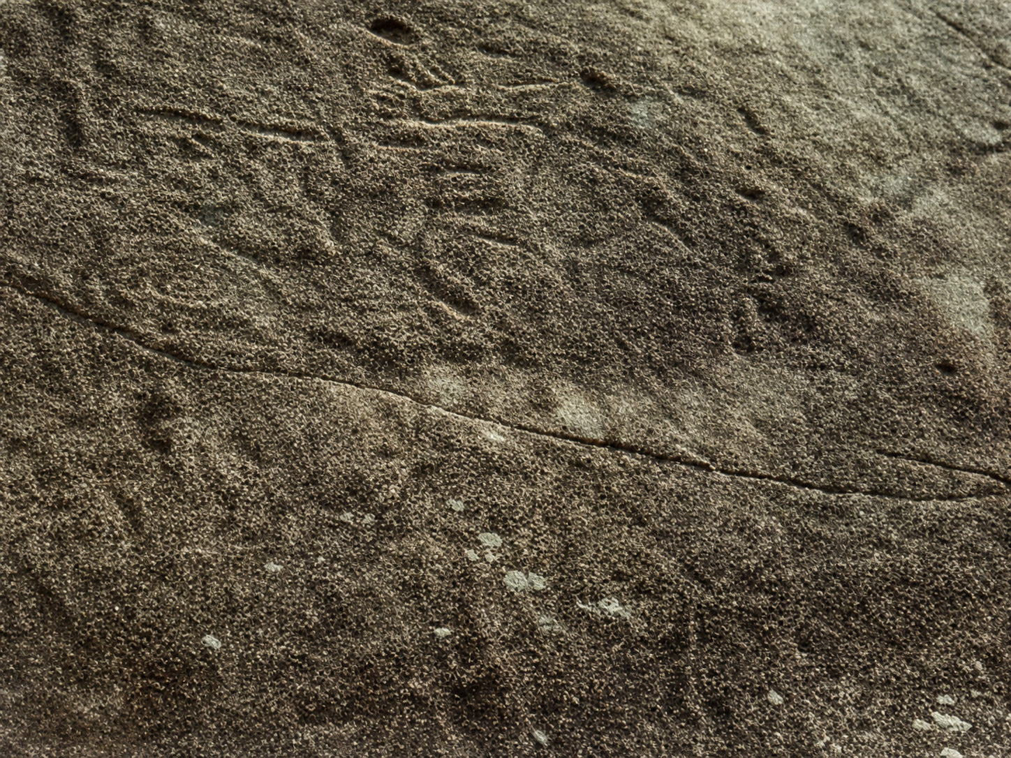
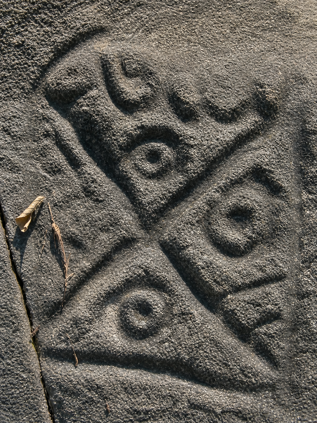
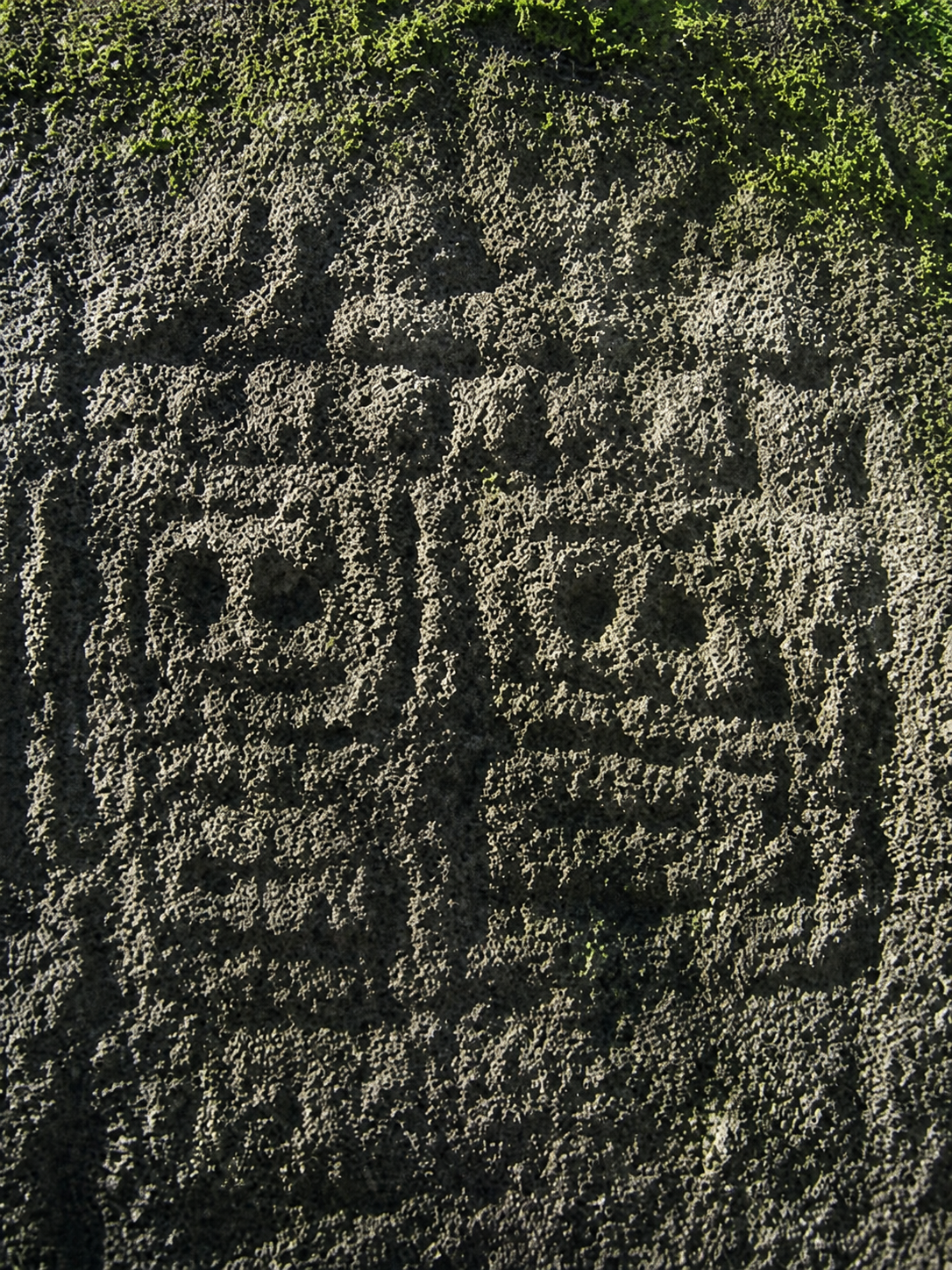
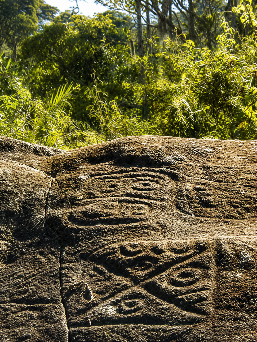
The identifiers I1–I4, B1–B4 and G1–G4 refer to images, not twelve independent rocks. Observations were made from the documentary sources; the displayed images are AI recreations credited to those sources. A recreation can alter continuity and texture, so it cannot be used to measure the engravings.135, 136, 137
Alzate and Osorio’s 2009 thesis offers a regional comparison: it records seven engraved rocks in Itagüí—two destroyed by dynamite—three in San Andrés, Girardota, and one rock with reported figures in Buga, Barbosa. These historical data are not a current census and do not individually identify the views shown here.129
Three levels of interpretation
We ask which segments connect, where they end, whether they form cycles and whether they share a branching point. A curve can change size or shape without losing these relationships.138
We also consider which outline encloses another, which units share a boundary and how they are grouped. Two separate circles and two nested circles have the same abstract graph, but a different arrangement on the surface.
The engraved network is distinguished from cracks, depressions, convexities and rock edges. The three-dimensional form of the rock affects visibility and cannot be recovered fully from a photograph.
For a finite graph of lines, β₀ = C counts connected components and β₁ = E − V + C counts independent cycles; V denotes vertices, E edges and C components. A forest connecting V vertices in C components uses V − C edges; each additional edge introduces a cycle. Points added merely to follow a curve do not change the result.139
No β₀ or β₁ values are assigned to whole panels: several contacts and closures are eroded, obscured or altered by recording. The numbers below apply exclusively to educational models, not tracings of these rocks.
These two numbers do not describe the entire structure: a connected X and a simple arc each have one component and no cycles, but only the X has a four-way junction. Endpoints, branching degrees and containment relationships are also needed. A line reaching the edge of a photograph is recorded as an unobserved continuation, rather than a true endpoint of the engraving.
Select a version of the diagram. A small link changes the structure; completing a groove by intuition changes the data.
Two components and two cycles: β₀ = 2; β₁ = 2.
The chord connects two points on the left circle; it does not join the two circles. This example reconstructs no particular petroglyph.
Comparative reading of the documentary sources
In I2, three curvilinear units stand out in a triangular arrangement. Their proximity organises an ensemble, but does not show that their grooves connect. Chalk makes the overall form legible while also making it difficult to decide whether some near-contacts are real junctions. ‘Three recognisable units’ and ‘number of graph components’, which remains undetermined, should be recorded separately.
This changes the question: beyond recognising spirals, we need to examine how their centres are distributed. The triangular arrangement could be a convention, a response to available space or an accumulation of interventions. A single photograph cannot distinguish between those possibilities.
I3 is especially promising. Units of different scales coexist and, on the right, a broad oval outline appears to enclose smaller marks and a subdivision. Below, another enclosing outline with an interior unit can be distinguished. The panel suggests a relationship between inside and outside, in addition to repeated curves.
Hypothesis: some compositions were built by placing units within a larger field. Here, ‘containment’ is spatial, not a social hierarchy. Uncertain contacts and the cropped part of the panel prevent every apparent outline from being treated as a confirmed cycle.
In G1, diagonals define sectors containing curves and depressions. G2 presents two approximately quadrangular fields beside a vertical axis, with internal marks and depressed points. G3 and G4 show wider compositions combining angular and curvilinear sectors. The strongest observation is the organisation into fields, rather than the name of a depicted figure.
A divided frame allows boundaries to be shared: one segment can separate two adjacent sectors. Nested curves, by contrast, create containment without necessarily sharing edges. This difference between enclosing and subdividing offers a more precise comparative criterion than grouping everything under ‘geometry’.
Modelling G1 would require confirmation that the diagonals actually join at the centre, reach the frame’s edges and meet a closed boundary. The four-cycle diagram shown above is a mathematical possibility conditional on those connections, not a result obtained from G1.
In I4, the row of rounded units and the elongated wavy line create a lateral organisation. That line could function visually as an axis or a division between sectors without touching every unit. In B4, the tracing highlights a radial group and bilateral forms around an axis; their exact connection requires comparison with the rock.
There are therefore two different networks: the physical network of grooves that touch, and the network of spatial associations between motifs. Confusing them would create non-existent connections. Nor does a line’s resemblance to flowing water demonstrate that it represents a river or a route.
B3 suggests radial marks, but wear prevents confirmation that they all converge on a common centre. The depression visible near the upper edge should not automatically be turned into that centre. B4 presents a more legible radial arrangement in the tracing; even there, identifying a ‘sun’ adds an interpretation that connections alone do not prove.
A system of rays joined at a point would involve branching; rays joined to a perimeter would have a different structure; small separate marks around a circle would form another. Distinguishing these variants is a potential archaeological result, even though none reveals the original meaning by itself.
G1 and G3 share features in the module of diagonals, curves and a lateral fracture; G4 may include parts of the same group. These are probable overlaps, awaiting identification in the field. They are not counted as three independent examples of one convention. In B4, repetition between the wide view on the left and the detail on the right is recognisable within the archive.
Moreover, B4 derives from a tracing rather than a photograph of the relief. The AI recreation transforms its detail into a plausible stone surface. That illustrated surface supplies no evidence about roughness, convexity or groove positions on the original rock. The tracing remains useful for comparing drawn relationships, within the limits of this mediated record.
The stone as part of the composition
I1 allows the visible outline of a rounded block to be recognised, but not its hidden faces to be reconstructed. I4 shows an elongated surface partly covered by vegetation. G4 reveals changes in slope and sectors visually separated by an extensive fracture. These differences matter for the distribution and perception of engravings; they are insufficient to identify the rock type, calculate actual size or reconstruct the entire rock.
In B1, a fracture crosses the field of the composite motif. In B2, irregular relief visually separates two spiral-like centres. In Girardota, cracks and surface transitions must be recorded as a separate layer from the grooves. A crack can divide the visible field without physically separating the entire rock. Its coincidence with a compositional division allows at least three explanations: the engraver used it, it later cut through the motif, or it coincides by chance. The photograph does not establish the sequence.
Depressions require another distinction. A cup mark cut into the surface may be an open bowl-shaped hollow; this does not make it a perforation passing through the stone. If a line surrounds a depression, the cycle belongs to that line’s drawing; it does not justify assigning a ‘topological hole’ to the block’s volume. Nor does G4’s dark shadow demonstrate a cavity or tunnel.
The observer matters. An assemblage on a curved face may be visible as a whole from one position and fragmented from another; a continuous line could disappear behind a change in slope. Length measured in pixels is not equivalent to distance across the rock. Studying accessibility, continuity between faces and viewing positions requires a scaled three-dimensional model.
Continuity does not reveal the history of work either. Two intersecting grooves may come from separate acts even if they now form one physical network. Profiles, depth, production traces and superimposition at the crossing would need examination to investigate sequences. A complex graph does not necessarily imply a design made in a single episode or more working hours than a simple one.
Rock-surface hypothesis: some compositions may have made use of natural boundaries or relatively continuous surface areas. This is a testable proposal, but not a demonstrated one. Engraving positions must be compared with available unengraved areas; observing only where motifs occur would make the argument circular.
A research hypothesis
Comparing relationships between motifs on petroglyphs, vessels, spindle whorls and other media—in the Aburrá Valley, Támesis, other parts of Antioquia and the middle Cauca region—could guide interpretations of their social meaning and their relationship to established regional chronologies.
The proposal is to compare combinations and rules of arrangement: what encloses what, how fields are divided, which elements share edges and which associations recur. An isolated spiral is a broad resemblance; the recurrence of several relationships within one composition offers a more specific hypothesis.
This approach has precedents. López Alzate and Velásquez Castro compare the Támesis petroglyphs with motifs on pottery and other objects. Their study broadens regional questions; its symbolic interpretations do not transfer automatically to the Aburrá Valley engravings.140 Piazzini, for his part, studies imagery on ceramic and metal objects from the middle Cauca region and its relationship with processes of social change.141
If uncommon associations are verified across independent media and contexts, they may indicate shared learning, circulating repertoires or forms of recognition. Their social function would need to be examined through the uses of objects, associated practices and find locations.
Associations of motifs on pottery with secure provenance and dated contexts would allow the engravings to be compared with established regional sequences. They might suggest relative temporal placement, persistence or transformation; formal resemblance does not directly date a rock or, by itself, assign it to a period.
A curved vessel, a perforated whorl that can rotate and a fixed rock offer different ways of arranging and perceiving motifs. Their surfaces and orientations would need comparison before a stationary figure, a rotating composition and a panel seen from several viewpoints could be treated as equivalent.
Assessing the hypothesis requires each case’s provenance, context, technique, chronology and uncertainty to be retained. Differences must also be sought: an association occurring across several periods would have little dating power, whereas a pattern restricted to well-documented contexts would be more informative. The aim is to build testable correlations without presupposing a single cultural identity.
Itagüí · El Rosario
AI recreations accompany the interpretation; relationships were checked in the documentary sources. Records by Luz Elena Martínez: Itagüí 1, 3 and 4 (1991), and Itagüí 2 (2006).135, 136, 137


Barbosa · Buga rural district
Documentary photographs: Luz Elena Martínez (Barbosa 1 and 2, 2006), Mauricio Obregón (Barbosa 3, 2003), and a tracing by Integral (Barbosa 4, 1997).135, 136, 137


Girardota · San Andrés rural district
Photographic records by Luz Elena Martínez: Girardota 1, 3 and 4 (2006), and Girardota 2 (1999).135, 136, 137
From findings to verification
Containment, partition and axial organisation suggest ways of combining units. Supporting a convention would require confirming its repetition on independent rocks and complete panels. The hypothesis would weaken if recurrences came from duplicates, closures introduced during modern recording or highly selected sectors.
The test involves recording cracks, slopes, edges and usable areas, including surfaces without motifs. We would then compare whether grooves end or change organisation beside those features more frequently than at alternative locations on the same rock. A lack of association would weaken the hypothesis; an association alone would not demonstrate intention.
Enclosing curves and subdivided fields allow regional comparison. Their value would increase if uncommon structures, associations of several motifs and verified techniques coincided in independently documented records. Similarity limited to circles or spirals is weak: it does not demonstrate contemporaneity, ethnic identity, travelling makers or shared meaning.
A 3D model would allow us to test which groupings can be seen together from accessible positions and which require movement. The hypothesis would weaken if the supposed groupings depended solely on camera framing. Astronomical alignments cannot be proposed here: orientation, local horizon, chronology and a specific test are missing.
The first step is to associate each image with a rock, face and motif. Decisive contacts—the central junction of G1, the boundaries of G2 and the outlines of I3—can then be selected for examination through photographs under varying illumination, without chalk or colouring. Reflectance Transformation Imaging (RTI) combines photographs lit from different directions to enhance surface detail; an institutional guide describes its use in heritage documentation.142 The overall relief would require scaled photogrammetry, adequate coverage and assessment of its errors.
Such documentation would support auditable tracings distinguishing confirmed grooves, uncertain contacts, fractures and unobserved areas. Each uncertain junction would have explicit variants; components and cycles would be recalculated to identify conclusions that hold across every variant. No line would be closed automatically on the basis of proximity or symmetry.
AI could help locate areas or suggest matches between photographs for a person to verify. Its scientific value here would be to facilitate recording and comparison, rather than complete grooves or decipher meanings.
The proposal that best withstands this review is to study petroglyphs as relationships constructed on particular surfaces. The records show centres, enclosing outlines, divisions, axes and changes of field; each organises how the whole is perceived. This offers more information than a list of ‘spirals, circles and geometric figures’.
It is reasonable to investigate whether that organisation encouraged recognition, the transmission of conventions or memory of place. These functions remain hypotheses: neither graph complexity nor the rock’s endurance demonstrates individual prestige, political authority, ritual use or a date. The new and defensible contribution is a programme for comparing relationships that includes both the rock surface and its documentation.
Vancouver referencing
Vancouver numbering follows first appearance across the project. Project bibliography.
Martínez LE, Hernández HJ, et al. Identificación y caracterización del patrimonio rupestre asociado a las áreas naturales de la jurisdicción de CORANTIOQUIA. Medellín: Corporación Autónoma Regional del Centro de Antioquia; 2006. Final report. The 2006 report has not been consulted in full; its records would help clarify the identification of these sites and their contexts.
Qualitative analysis based on documentary records, prepared with AI assistance. Connections that cannot be verified remain unresolved. The diagrams are original educational vector drawings produced for this revision, not archaeological tracings. The accompanying public-facing images are existing project recreations.