How stones ‘speak’ · 02

Transforming the landscape with stone

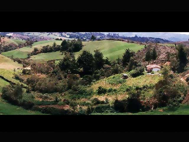
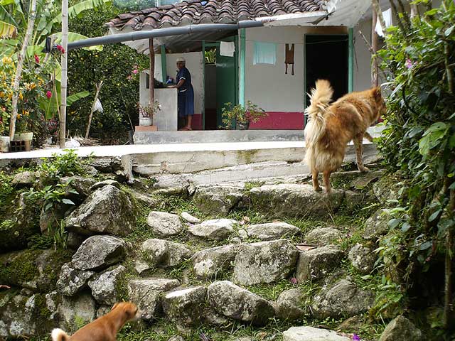
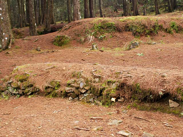
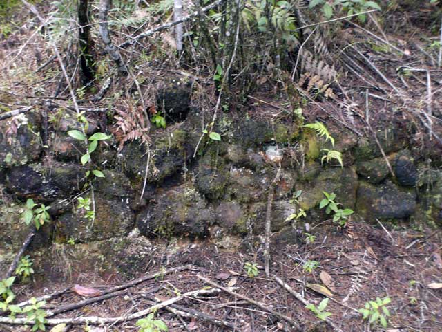
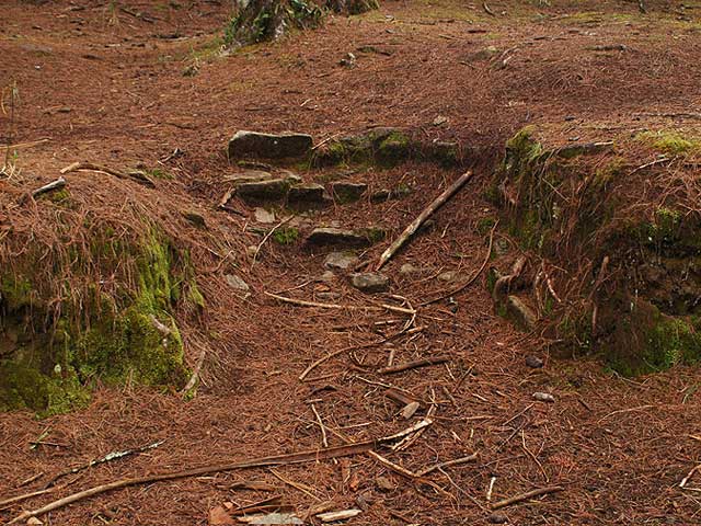
Walls, terraces, platforms, channels and paths form a palimpsest: an accumulation of construction, repair and reuse that does not necessarily belong to a single period.

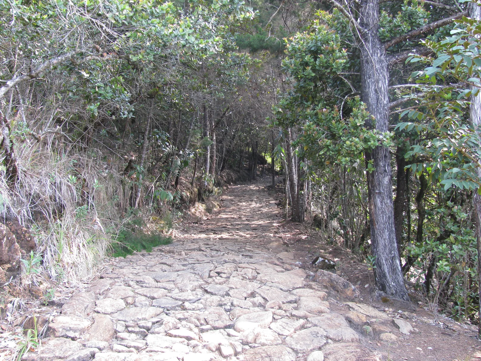
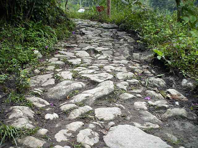
El Hatillo path, Barbosa
El Hatillo path, Barbosa. Proyecto AD, photographic archive of the original project, 2007.143

Landscape and time

Building, maintaining, abandoning and reusing

Stone has mediated relationships between societies and territory in many regions: it retains soils, channels water, stabilises slopes, defines spaces and facilitates movement. Its durability can preserve a structure, but also allows later generations to repair, dismantle or incorporate it into new practices. The archaeological landscape is therefore not a frozen scene.144, 145

In the Aburrá Valley and its highlands, a single slope may bring together natural outcrops, Indigenous constructions, colonial and republican alterations, and recent repairs by rural communities. Formal similarity is not enough to assign a date or identify the builders: stratigraphy, associated materials, construction relationships, historical documentation and analysis of the route are needed.36

Mobility · From the Valley to the highlands

Paths with more than one history

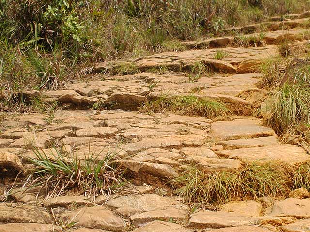
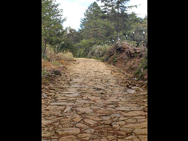
The Niquía–San Pedro de los Milagros path, on Quitasol hill in the municipality of Bello, is one of the many stone-paved routes connecting the Aburrá Valley with the highlands.

Background to the debate

Four studies, a history still to be clarified

The first three studies are summarised through Corantioquia’s 2023 assessment, which brings them together and compares them.

Gonzalo Ospina · 1999. His Quitasol survey attributes the Niquía–Corrales paving to the Jaramillo family in the mid-twentieth century, as vehicle access; it allows for possible earlier elements (assessment, p. 22).117

Sofía Botero · 2007. The ancient-paths survey describes the San Pedro–Quitasol–Niquía route, approximately 16.7 km long, distinguishing surviving paving from contemporary restorations using a different construction technique (p. 6).117

Pablo Aristizábal · 2021. His study considers the structures pre-Hispanic, although test excavations produced no archaeological evidence in stratigraphic association. ICANH approved his management plan in 2022; that approval does not constitute a date determination (p. 42).117

Santiago Montoya · Corantioquia and Politécnico Jaime Isaza Cadavid · 2023. The assessment reviews earlier interpretations. Its historical review recognises regional Indigenous routes, but cannot document when this path was built or demonstrate its specific pre-Hispanic origin (pp. 40–41).117

From materials to maintenance

The construction and life of a stone path

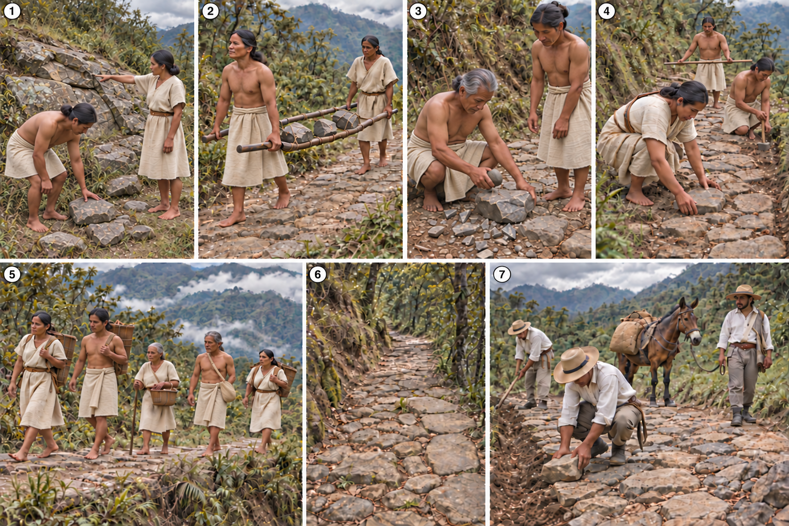
Seven moments for imagining stone selection, transport and working, the use of the path and its repairs.

Seven panels: stone selection, transport on a carrying frame, preparation, paving, people using the path, abandonment and later repair with a pack mule.
Illustration of the operational sequence. Select the image to enlarge it.
The sequence in motion · 42 seconds. Montage of twelve shots selected after reviewing nine clips: selecting, carrying and shaping stones, construction, use, abandonment and repair of the path.

Interpretative recreation: a hypothetical sequence, rather than the established history of the Quitasol path.

Illustration and video credits

Direction and sequence concept: Julián de Jesús Pérez Ríos · Proyecto AD. Images generated with OpenAI’s image tool; animation and sound generated with Gemini. Montage made with Codex assistance. October 2026.

The original illustration is preserved in full. The video includes the ruined dry-stone boundary wall and corrected carrying straps; the abandonment shot uses a digital camera movement across a still image. Images and sound are contemporary recreations.

Read the seven stages and their context
  1. Finding and selecting materials

    Examining available stones and choosing forms, surfaces and sizes suited to paving. Selection takes account of durability, how firmly stones can be seated and the effort required to carry them.

  2. Transport on a carrying frame: parihuela or guando

    Two people share the load using a frame of two long guadua bamboo poles joined by a mat and lashings. The stone rests in the centre; each person holds the pole ends at one end of the frame.

  3. Shaping in a working area

    In a working area, stone faces are compared and protrusions adjusted where needed. Natural forms are used to prepare pieces that can be seated securely and fitted together.

  4. Terrain-responsive paving under skilled guidance

    The route follows the terrain. People with construction knowledge guide preparation of the base, the fitting of irregular stones, joint filling and drainage. Coordinated work gives the passage continuity and stability.

  5. Use

    The path facilitates the movement of people and goods. Traffic and rainfall cause wear, while cleaning and maintenance help preserve it.

  6. Abandonment

    As traffic declines and maintenance stops, leaves and sediment accumulate, vegetation grows between joints and some stones shift. The process may affect some sections more than others.

  7. Repair and use after the conquest

    The final scene imagines the restoration of a section: stones are repositioned, drains cleared and traffic returns, now including a pack mule. Local knowledge and later interventions can leave overlapping traces in the same structure.

A sequence for thinking about construction

The illustration presents one possible organisation of work, not the established history of a specific path. Not every path originated before the conquest or passed through these stages in this order. The chronology of each section requires comparison of construction relationships, excavations and historical documentation.36

AI recreation created for Proyecto AD using OpenAI’s integrated image generator, October 2026. Sequence proposed by the project’s director. People, clothing, tools and actions are interpretative devices.

The project’s interpretation

Indigenous foundations, transformed through time

To appreciate the scale of the work required to pave the Niquía–Corrales path, we can consider a hypothetical calculation: if the route were 7 kilometres long and averaged 3 metres wide, its paved surface would cover 21,000 square metres. Assuming that every 3 square metres of paving required one tonne of stone, approximately 7,000 tonnes of stone would have had to be obtained, transported and laid. This estimate illustrates the scale of construction effort; it is not a measurement of the material actually used.

On this reasoning, the author questions whether this monumental work could have been built during the conquest, within the region’s extractive colonial society, by the severely underfunded republican administration, or by a wealthy family in the late twentieth century, given the absence of historical records of extensive paving works along the route. He concludes that a route of these characteristics could only have been built over the long span of pre-Hispanic life in the Aburrá Valley. This leaves an open question: What kind of society produced infrastructure like this?35

  1. Material scale and the organisation of labour The author estimates that the work contains thousands of tonnes of stone: a field-based assessment awaiting volumetric measurement. Locating, moving and laying that material requires labour, time and provisioning to be considered. Attributing the whole work to a family initiative requires an explanation of how those resources were mobilised.
  2. An organic design and an engineering solution During his field visits, the author recognises an integration of route alignment, paving, gradients and hydraulic works. Stone placement responds to the terrain and water management. For the project, this integration makes long-established infrastructure more plausible than a work built entirely as recent private access.
  3. Gradients and surfaces for movement Steep gradients and smooth surfaces make safe passage difficult for horses. The project considers these features better explained by a logic of pedestrian movement, subsequently adapted to other uses.
  4. Population, budgets and construction capacity Low post-conquest population density in the area and the limited resources the author identifies during the conquest, colonial period and much of the republican period into the twentieth century reinforce his objection to construction entirely within those periods. A reuse hypothesis helps explain the survival of a work whose initial effort would have been collective and Indigenous.
  5. A 4×4 vehicle’s passage does not date construction The author records an oral account that a 4×4 vehicle once travelled along the path. That testimony may inform us about later use or adaptation; it does not establish who opened the route or laid its original paving.
  6. Attribution to the twentieth century needs documentary support The project is unaware of documents proving that the Jaramillo family built the entire work. An attribution reported in the literature must be distinguished from documentary proof of construction. The absence of documents alone does not provide a pre-Hispanic date either.

The path’s layers

A palimpsest with Indigenous foundations

A palimpsest is a work in which interventions from different periods overlap without completely erasing earlier ones. On a path, the alignment, paving, drains and repairs may belong to different moments. This perspective helps interpret its transformation and the coexistence of different forms of travel.36

The project proposes reading this path as a work of long duration: very probably founded on Indigenous labour, recognised, travelled and transformed during colonial, republican and contemporary times. Later records, memories and uses would be layers of that history, rather than necessarily accounts of its origin. This is the historical hypothesis defended here; it does not imply that every visible stone is pre-Hispanic or that uninterrupted continuity has been demonstrated.35

Distinguishing evidence from this interpretation

The opening synthesis presents the studies through the 2023 assessment; the arguments set out here express the author’s interpretation based on field experience and historical-archive research. The 2007 photographs show the paving and its surroundings. Volume estimates, oral accounts and attributions of authorship require specific cross-checks to date the work’s different stages.

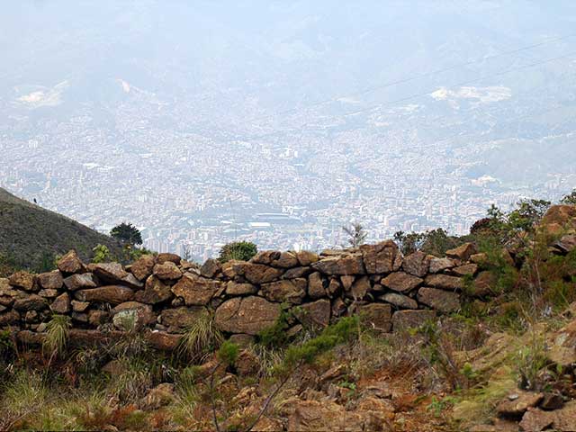
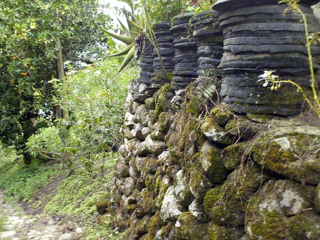
Stone boundary wall on Medellín’s central-eastern hillside, with the city beyond
Roadside wall with the city in the background: Camino de la Cuesta, Aburrá Valley, 2007. Photograph: Proyecto AD.146

The social production of space

Walls alongside paths

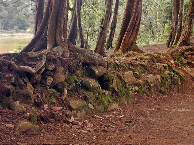
According to field observations by the project’s author, the photographed wall forms part of a continuous structure accompanying the upper section of the so-called Camino de Cieza, which connects present-day central Medellín with the Santa Elena highlands. Its relationship with the path invites us to understand it as part of a wider organisation of territory.

For the project, invoking the concept of a palimpsest can become a way around our difficulty in understanding that history. Recognising that a work accumulates interventions from different periods is useful, but naming the overlap does not explain who built it, how labour was organised or what social relationships gave meaning to its endurance. The concept should open those questions, not close them.

The project’s critical reading holds that these structures express a social production of space that does not fit the extractive and pragmatic logics of the groups that have historically shaped Antioquian society. Understanding them requires considering other ways of inhabiting, connecting and constructing territory, including Indigenous knowledge and labour. Later uses and repairs form part of the historical problem; they are not enough to explain the work’s conception.35

Critical synthesis

A palimpsest is not an undifferentiated mixture

In archaeology, a palimpsest is a record in which actions separated in time overlap, partially erase, displace or reuse materials and structures. It does not mean that everything forms an undifferentiated mixture: it requires us to recognise different temporal resolutions and reconstruct, section by section, relationships of earlier construction, repair, abandonment and reoccupation.36, 145

Paths, walls, terraces and channels frequently show what Proyecto AD calls organic design: alignments adjusted to outcrops, gradients, drainage, crossings and the stone available at each place, which may have grown through successive additions and repairs rather than following a single plan. This integration with the local stone setting is observable; attributing it to a particular period or population requires stratigraphy, associated materials, construction analysis and historical documentation.36, 110

Vancouver referencing

References

Studies summarised through the assessment are identified as indirect citations. The author’s interpretations are distinguished from publications and the photographic archive. For further discussion, see Botero, Caminos ásperos y fragosos para los caballos115, and Pérez Ríos, Caminos antiguos en el Valle de Aburrá148.

  1. Proyecto AD. Observaciones de campo e interpretación histórica y arqueológica de los caminos del Quitasol y de los muros acompañantes del camino de Cieza [author’s communications and project content]. 2026 Sep 27 and Oct 2. Includes the hypothesis of a pre-Hispanic Indigenous foundation and economic reasoning concerning colonial, republican and twentieth-century attributions. The specific historical documents underlying that economic argument were not individually identified in this review. Available from: https://proyectoad.org/htdocs/piedra_construcciones.html View source
  2. Botero Páez S. Elementos para leer un palimpsesto: indígenas, caminos, piedras, mulas y caballos en Colombia. Bol Antropol. 2006;20(37):265-287. doi:10.17533/udea.boan.6899. View source
  3. Botero Páez S. Gente antigua, Piedras Blancas, campos circundados. Vestigios arqueológicos en el altiplano de Santa Elena (Antioquia, Colombia). Bol Antropol. 1999;13(30):265-305. doi:10.17533/udea.boan.337542. View source
  4. Botero Páez S. Piedras Blancas: transformación y construcción del espacio. Investigación arqueológica en la cuenca alta de la quebrada Piedras Blancas. Informe de prospección. Bol Antropol. 1997;11(27):124-167. doi:10.17533/udea.boan.338722. View source
  5. Botero Páez S. Caminos ásperos y fragosos para los caballos: apuntes para la historia de los caminos en Antioquia. Medellín: CODI-CISH, Departamento de Antropología, Universidad de Antioquia; 2005. ISBN 958-655-851-7 [Internet; cited 2026 Aug 23]. Available from: https://redcol.minciencias.gov.co/Record/UDEA2_c7360903544c0bc4b35291caf523d8bb View source
  6. Montoya Agudelo S. DRMI Quitasol–La Holanda: diagnóstico arqueológico [Internet]. Medellín: CORANTIOQUIA; Politécnico Colombiano Jaime Isaza Cadavid; 2023 [cited 2026 Sep 27]. p. 6, 22, 40–42. Synthesis consulted for the studies by Ospina (1999), Botero (2007) and Aristizábal (2021); the three original reports were not consulted here. View source Additional link
  7. Proyecto AD. Estructuras y caminos de piedra del Valle de Aburrá [photographs]. Photographic archive of the original project; 2007. Includes ten photographs of the Niquía–San Pedro de los Milagros path on Quitasol hill, Bello; authorship and date confirmed by the project’s author on 27 September 2026.
  8. Ingold T. The temporality of the landscape. World Archaeol. 1993;25(2):152-174. doi:10.1080/00438243.1993.9980235. View source
  9. Bailey G. Time perspectives, palimpsests and the archaeology of time. J Anthropol Archaeol. 2007;26(2):198-223. doi:10.1016/j.jaa.2006.08.002. View source
  10. Proyecto AD. Plataformas, muros y escalas: Santa Elena, Medellín, 2007; muro acompañante del Camino de la Cuesta, Valle de Aburrá, 2007 [photographs]. Visual archive of the project. Includes roca06.jpg.
  11. Botero Páez S. Campo circundado en Santa Elena [photograph]. Visual archive of the original project; 1990s; precise year to be confirmed.
  12. Pérez Ríos JJ. Caminos antiguos en el Valle de Aburrá: cuando el bosque no deja ver los árboles. Bol Antropol. 2011;24(41):484-488. doi:10.17533/udea.boan.7991. View source
Niquía–San Pedro de los Milagros